


Google Map New Screenshots/Drawing.png Google Map New Screenshots/Geo-tags.png Google Map New Screenshots/Import Locations.png Google Map New Screenshots/Manage Backups.png Google Map New Screenshots/Manage Routes.png Google Map New Screenshots/Map-information.png Google Map New Screenshots/Maps-center.png Google Map New Screenshots/Screen Specific Settings.png Google Map New Screenshots/acf-plugin.png Google Map New Screenshots/add-route.png Google Map New Screenshots/api key.png Google Map New Screenshots/choose-locations.png Google Map New Screenshots/control-position-settings.png Google Map New Screenshots/control-setting.png Google Map New Screenshots/cutom-control-settings.png Google Map New Screenshots/design-settings.png Google Map New Screenshots/extra-fields-settings.png Google Map New Screenshots/extra-fields.png Google Map New Screenshots/geojason.png Google Map New Screenshots/infowindow-according-schema.png Google Map New Screenshots/infowindow-customization.png Google Map New Screenshots/infowindow-settings.png Google Map New Screenshots/layers settings.png Google Map New Screenshots/limit-panning-settings.png Google Map New Screenshots/listing-category.png Google Map New Screenshots/listing-grid.png Google Map New Screenshots/listing-list.png Google Map New Screenshots/listing-settings.png Google Map New Screenshots/listing.png Google Map New Screenshots/location-information.png Google Map New Screenshots/manage-loc.png Google Map New Screenshots/map-style-settings.png Google Map New Screenshots/marker-categories.png Google Map New Screenshots/marker-cluster-settings.png Google Map New Screenshots/overlay-settings.png Google Map New Screenshots/route-direction-settings.png Google Map New Screenshots/route-information.png Google Map New Screenshots/snazzymap-styles.png Google Map New Screenshots/street-view-settings.png Google Map New Screenshots/tabs-category.png Google Map New Screenshots/tabs-design.png Google Map New Screenshots/tabs-direction.png Google Map New Screenshots/tabs-nearby.png Google Map New Screenshots/tabs-settings.png Google Map New Screenshots/way-points.png
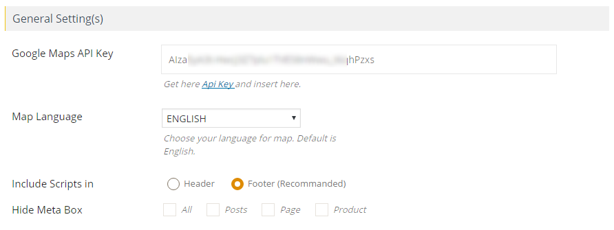
Show customizable Google Maps on your WordPress website with ease. Effortlessly showcase locations, custom post types, custom fields, routes, directions, category filters, location filters, and nearby locations on Google Maps. Display store locators with location filters. Our WordPress plugin for Google Maps ensures seamless GDPR compliance, providing you with a professional and secure mapping solution.
Take a Quick Look
Features
- GDPR Compliance: We have seamlessly integrated support for the major WordPress GDPR plugins – Complianz – GDPR/CCPA Cookie Consent, GDPR Cookie Compliance (CCPA, DSGVO, Cookie Consent), CookieYes | GDPR Cookie Consent & Compliance Notice (CCPA Ready), iubenda | All-in-one Compliance for GDPR and Cookie Notice.
- Easy filtering: With this plugin, you can easily filter locations based on custom fields, taxonomies, and location data. You can create multiple filters using the backend, giving you greater control over your location data.
- Display posts: This plugin allows you to display posts, pages, or custom post types on Google Maps. You can even display multiple post types on a single map, making it easy for visitors to find relevant content.
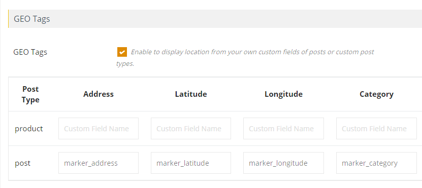
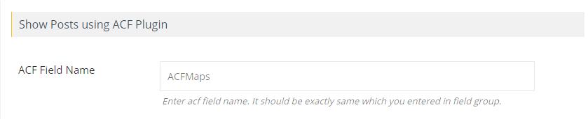
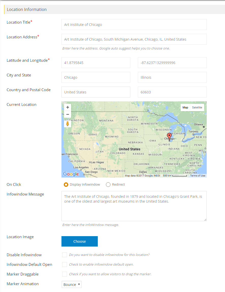
- Assign locations: Assigning a location to your post is easy with this plugin. You can do it using the meta box or your own custom fields. If you use the Advanced Custom Fields plugin, you can assign a location to your post in a more customized way.
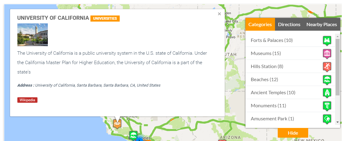
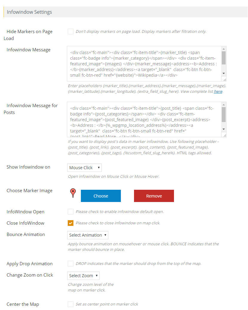
- Display post information: You can display a wide range of post information in an info window, including title, content, excerpt, featured image, categories, tags, custom fields, and custom taxonomies. All you need to do is use placeholders to display this data.
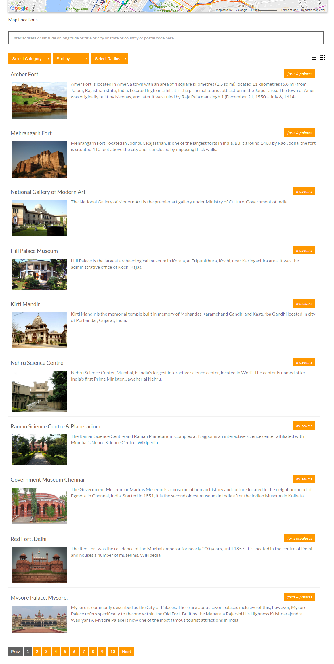
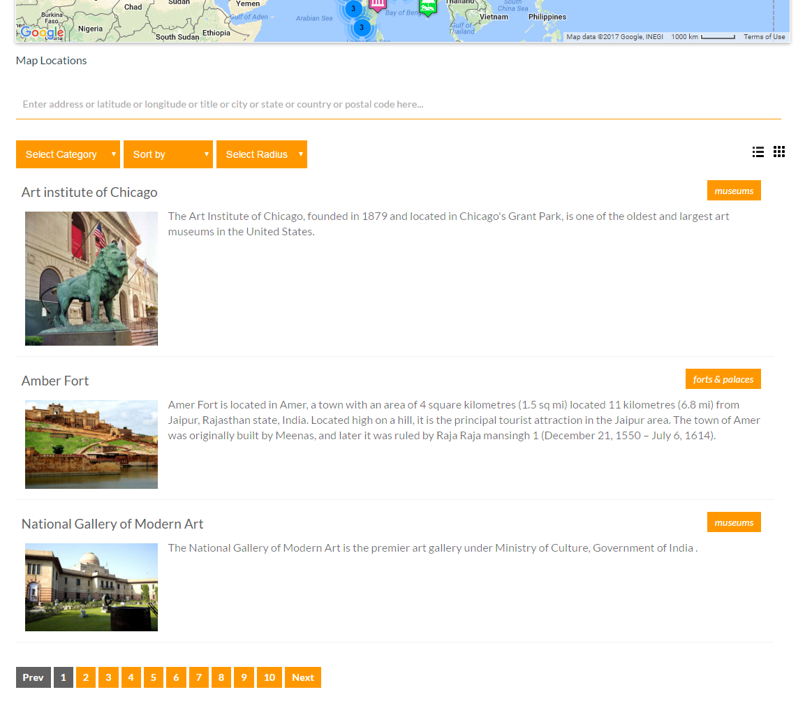
- Customizable post listing: This plugin allows you to display a list of posts below the map and customize the HTML easily to match your own design. You can also show post information in the listing, making it easy for visitors to find the content they need.
- List display options: Visitors can switch between grid and list formats for displaying posts or locations below the map. This feature adds greater flexibility to your location-based content.
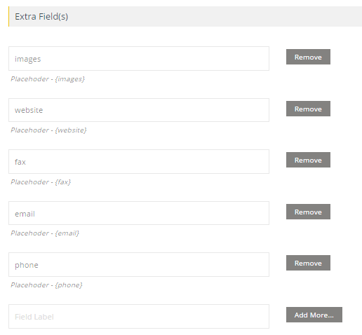
- Custom marker details: You can add any number of details to location or marker details and display them in an info window. This includes details such as fax, phone, email, website, and more.
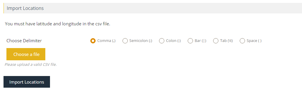
- CSV import: This plugin makes it easy to import unlimited location data from CSV files. You can import any number of fields in the location and assign categories to your location using CSV. All CSV delimiters are supported.
- Filter by category: With this plugin, you can assign multiple categories to a location and allow visitors to filter by categories. This feature adds greater organization to your location-based content and makes it easy for visitors to find what they need.
- Clickable markers: You can choose to have markers on the map redirect visitors to a location or display an info window message when clicked. This feature is available for both posts or manually added locations.
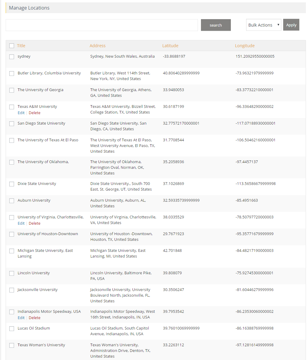
- Listing module: A comprehensive listing module is available to filter, sort, and search for posts or locations by zip, address, city, country, post title or location title, and categories. This module includes an advanced search box that provides an easy-to-use and fast search experience.
- Radius search: This feature allows you to search for postAjax search: The listing module is Ajax-based, ensuring the fastest search experience and usability.
- Filter by category: You can filter markers on the map by category, and you can choose to filter multiple categories at once.
- Sort listing: The listing module allows you to sort posts or locations by title, address, or category in both ascending and descending order.
- Print option: You can provide a print option to your visitors to print a filtered location listing. This feature can be controlled via the backend.
- Custom placeholders: This feature allows you to modify location listing data without any programming. You can customize placeholders to suit your requirements.
- Customize options: You can customize various options in the backend, including enabling or disabling the search form, category filter, print option, and sorting options.
- Pagination support: The listing module supports pagination. You can set the number of posts or locations per page using the backend setting.
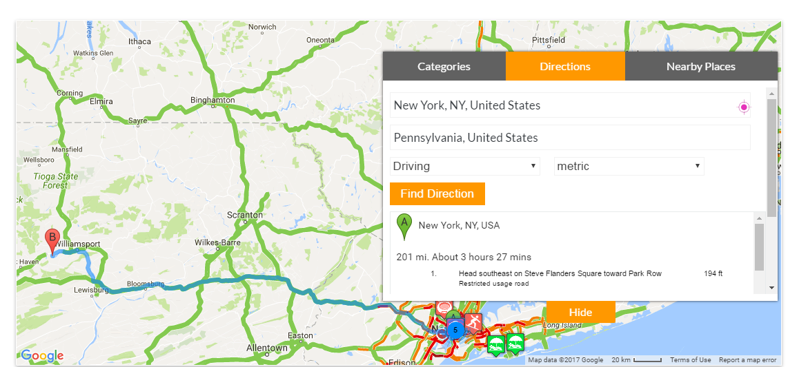
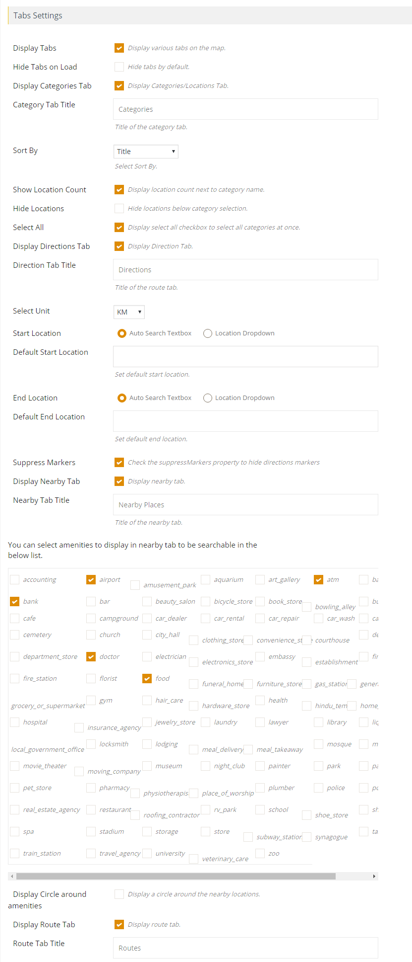
- Route directions: You can ask visitors to provide the start and end locations to show them route directions. They can click on the marker to automatically fill in the start location. This feature supports driving, bicycling, walking, or transit route information.
- Unit Conversion: Visitors can choose to get route directions in miles or kilometers.
- Location Input Options: Display start and end location input as a textbox or select box filled with your locations.
- Default Locations: Display default start and end location in the directions tab.
- Google Places API: Use the Google Places API to get nearby places within a certain radius.
- Circle Display: Display a circle around amenities found using the Google Places API.
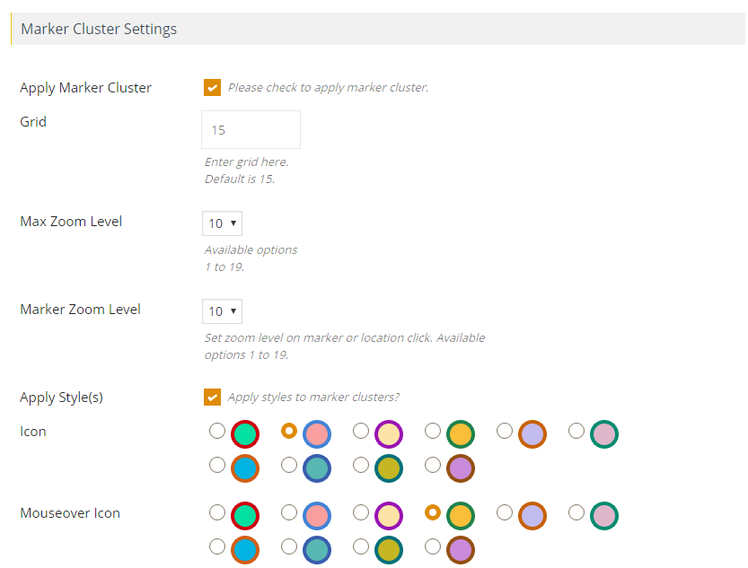
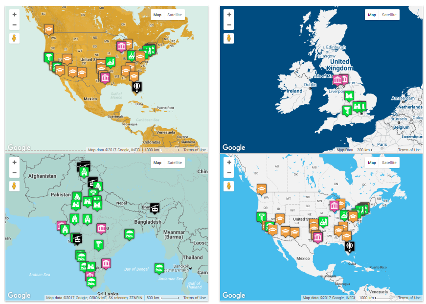
- Marker clustering: Enable marker clustering to group multiple locations and improve map readability. Choose from 10 available styles to customize cluster appearance.
- Dynamic marker clustering: Apply marker clustering to posts and locations, which automatically update with filtration, ensuring the latest and most relevant information is displayed.
- Custom marker cluster icons: Choose marker cluster icons and mouseover icons to provide a better user experience.
- Grid size and zoom level customization: Customize marker cluster grid size and max zoom level to suit your specific needs and preferences.
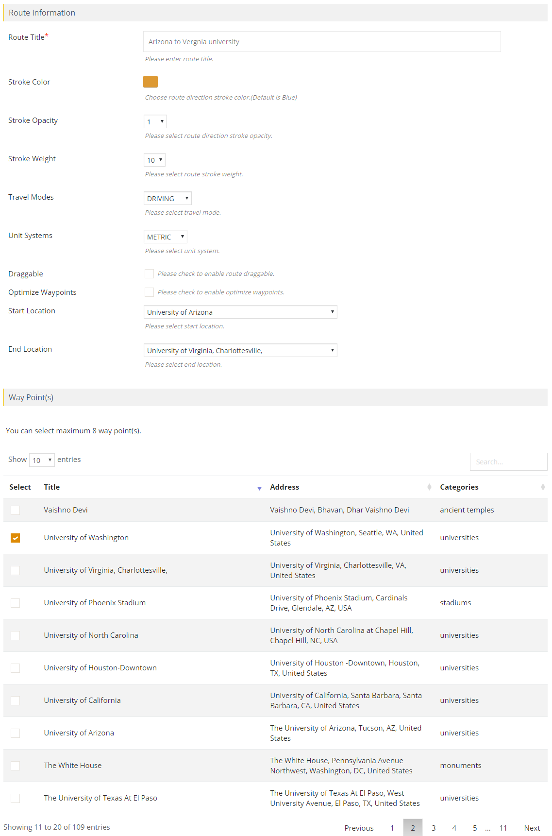
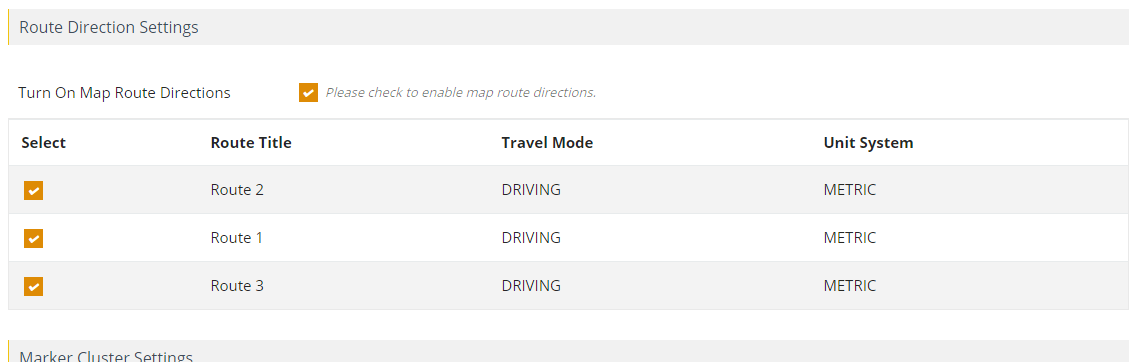
- Create multiple routes: Create multiple routes with assigned colors, waypoints, and optimized routes to provide visitors with the best possible path to their destination.
- Customize routes: Customize various aspects of routes, including stroke color, stroke opacity, stroke weight, travel modes, unit systems, start location, end location, and waypoints.
- Make routes draggable: Make routes draggable for ease of use and suggest optimized waypoints to enhance the user experience.
- Assign waypoints to routes: Assign waypoints to routes using a searchable location list for efficient route planning and customization.
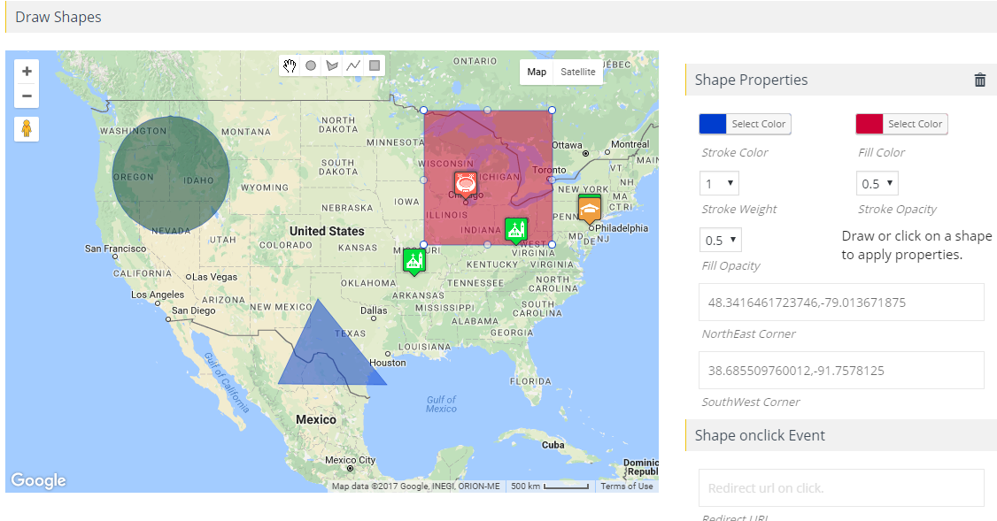
- Draw shapes with infowindows: Draw multiple clickable circles, rectangles, polygons, and polylines with infowindows and redirecting capabilities to provide additional information to visitors.
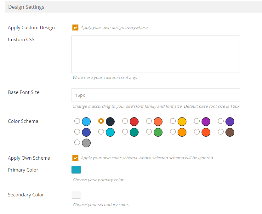
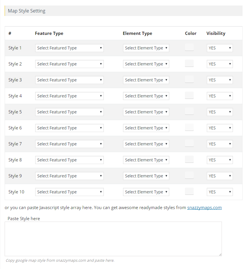
- Custom map styles: Create custom Google Maps styles for roads, labels, and geometry to make your maps unique and reflective of your brand.
- External location sources: Fetch locations from external sources with automatic latitude, longitude, city, country, state, and zip code assignment to save time and effort.
- Marker management: Manage parent-child categories with assigned custom markers or choose from over 500 ready-made markers to make your maps more organized and user-friendly.
- Infowindow customization: Customize infowindow message body with placeholders and modify contents via hook using programming to provide visitors with the information they need.
- Marker animation: Apply Bounce and Drop Animation to markers for better visibility and a more engaging user experience.
- Display multiple layers: Display multiple KML/KMZ layers, fusion tables, real-time traffic, bicycle path information, and physical maps on the same map to provide a comprehensive view of the area.
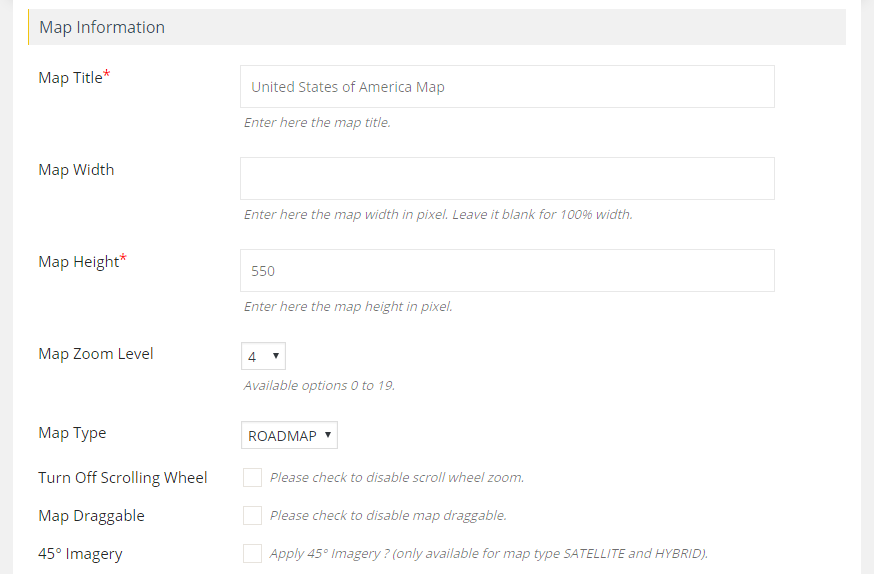
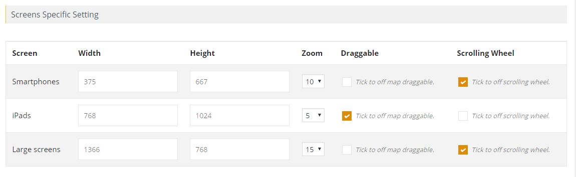
- Map properties customization: Set properties such as height, width, zoom level, map type, and scrolling wheel. Ensure fully responsive maps that adjust according to the device used to access them.
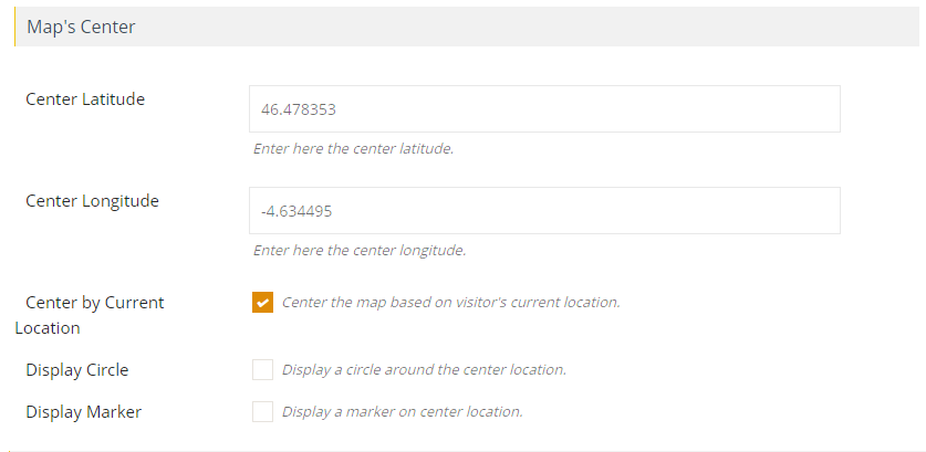
- Location-based mapping: Center the map based on the visitor’s current location, making it more personalized and relevant.
- Circle display: Display a circle around the center location and customize its properties to provide additional information and enhance the user experience.
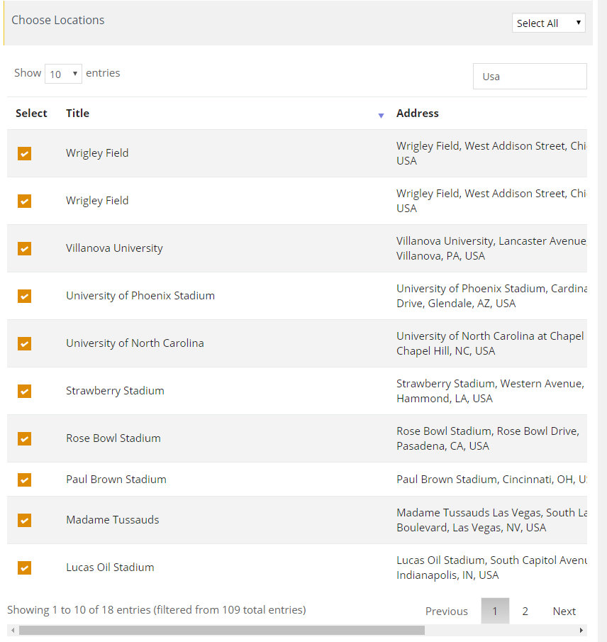
- Multiple location assignment: Assign multiple locations using searchable listings that are paginated for hundreds of locations to make it easier for visitors to find the information they need.
- Maps Controls: Enable or disable various controls on the map such as the Zoom Control, Full Screen Control, Map Type Control, Scale Control, Street View Control, and Overview Map Control. Customize their position on the map for optimal user experience.
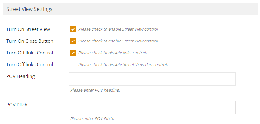
- Street View: Provide visitors with an immersive experience by displaying a Street View of the location with customizable POV (Point of View) Heading and POV Pitch. Allow them to explore the area around the location in detail with this feature.
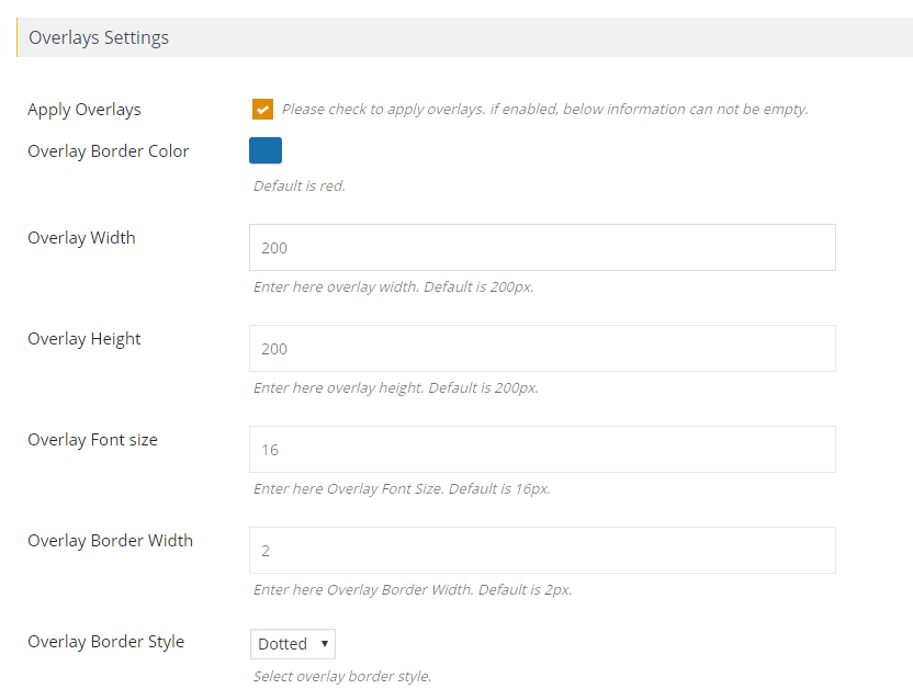
- Customize overlay settings: Enhance your map with customizable overlays that allow you to adjust border color, width, height, font size, border width, and border style to fit your website’s design.
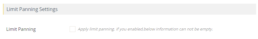
- Limit panning and dragging: Keep your map view focused by utilizing the limit panning feature, which restricts users from dragging the map beyond a specified boundary.
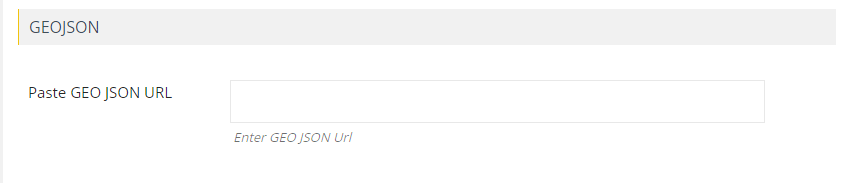
- Display GEOJSON data: Display your data in a user-friendly way by easily accessing GEOJSON data using a URL.
- Widget-ready maps: Take advantage of widgets and easily display Google Maps in sidebars with multiple maps on a single page, each with their own unique properties.
- Tabbed display: Simplify your map interface with tabbed displays that show categories, directions, routes, and nearby locations all in one view, complete with location counts and sorting options.
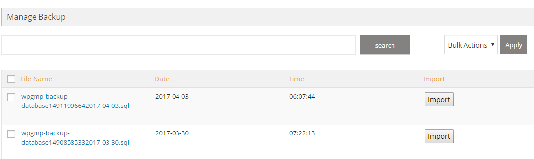
- Backup and permissions: Keep your data secure and organized with automatic backups of locations, routes, maps, and categories, as well as assigned permissions to users.
- External data sources: Use the new filter wpgmp_marker_source to add markers to Google Maps using external databases or sources, increasing the flexibility of your website.
- Multiple maps on a page: Improve user experience by allowing visitors to view multiple Google Maps on a single page, each with its own unique properties, enhancing the overall functionality of your website.
- Cross-browser compatibility: Ensure that your maps function seamlessly on all major browsers, including IE8, IE9, IE10, and more, for a smooth user experience.
- Multilingual support: Expand your audience by offering multilingual support with .po files, making your website accessible to users worldwide.
- Multisite compatibility: Activate this plugin network-wide on your multisite setup with ease, making it simple to manage maps across your entire website.
- Custom Gutenberg Map Block: Enhance your page content with ease by using our custom Gutenberg Map Block component, designed to help you effortlessly add and preview maps on your website.
- Spiderfier Effect: Improve your map’s usability with the Spiderfier Effect, allowing your visitors to elegantly view data of overlapping markers with the same latitude and longitude.
- SEO-optimized: Boost your website’s visibility and ranking on search engines by optimizing your Google Maps plugin for SEO with our SEO-optimized features.
- Responsive: Ensure a seamless user experience on all devices with our responsive design, making your maps look great on any screen size.
- Customizable: Personalize your Google Maps to fit your brand’s unique style and preferences with our wide range of customizable options, including map style, marker icons, and more.
- Fast Loading: Keep your visitors engaged with fast-loading maps, designed to load quickly and efficiently for a smooth and seamless browsing experience.
Extensions
Unlock the full potential of this Google Maps WordPress Plugin with our premium extensions – www.wpmapspro.com/shop
- Airtables to Google Maps
- Bookmark Locations
- Buddypress Members
- CF7 Submissions
- Customer Itinerary
- Excel to Google Maps
- Filter Maps by View Port
- Frontend Submission on Google Maps
- Gravity Form Submission on Google Maps
- JSON to Google Maps
- Mysql Database to Google Maps
- Nearby Amenities on Google Maps
- Advance Search Widget
- WordPress Users on Google Maps
- Listing Designs for Google Maps
Most Recents Change Log
Version 5.6.0
- New: GDPR-supported Google Maps
- Fix: Bugs & Improvement fixes
Version 5.5.9
- Fix : Bugs Fixes & Improvements
Version 5.5.8
- Fix : Issue related to ACF's google map type field fixed.